 GuardTrails
Kyrgyzstan · July
The classic
The Classic Kyrgyz Highlands Loop
The stops adventure tour operators put in their flagship trips here — even if it strays a little from your request.
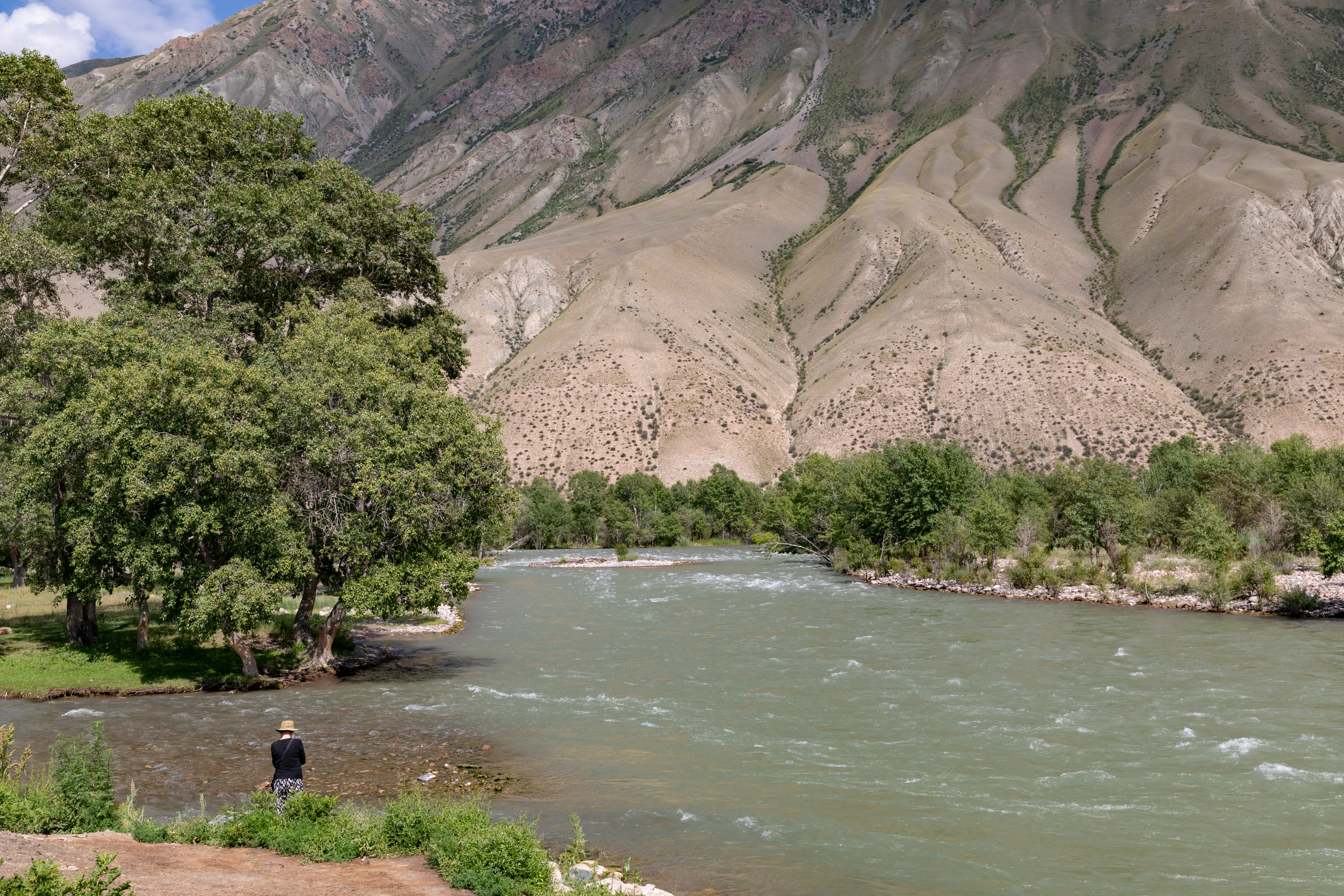
Experience the quintessential Silk Road journey, combining the legendary high-altitude pastures of Song-Köl, the ancient stone caravanserai of Tash Rabat, and the dramatic red canyons of Kyzyl-Oi.
- Slightly higher proportion of yurt camp stays instead of hotels to experience the classic nomadic lifestyle at Song-Köl and Tash Rabat.
- Slightly more physical effort required for the high-altitude pass crossings which are essential to the classic trekking route.
- days27
- bases16
- stages22
- nights26
- transfer days15
- stage to stage≈ 2,126 km
- at the wheel, day by day≈ 40 h 01
includes legs from an approximate position
Who this itinerary is for
This itinerary suits a traveller looking for: a trip in July, days of walking, a day hike and a village stroll.
The area
the classic loop from Bishkek through Chon-Kemin, the high-altitude pastures of Song-Köl, the historic Tash Rabat caravanserai, and the red canyons of Kyzyl-Oi
The map
Loading the map…
The days at a glance
One line per day: where you sleep, what the day is, the road, and how its time is split.
| Day | Evening base | The day | Road | Time of the day |
|---|---|---|---|---|
| Day1 | Evening base : Bishkek | ArrivalBishkek, arrival | Road 38 min | 5.0 h usable |
| Day2 | Evening base : Tokmok | TransferAncient Burana Tower | Road 1 h 19 | 5.0 h usable |
| Day3 | Evening base : Tar-Suu | TransferChon-Kemin Alpine Valley | Road ≈ 1 h 30 | 8.0 h usable |
| Day4 | Evening base : Cholpon-Ata | TransferCholpon-Ata Petroglyphs | Road ≈ 2 h 34 | 12.0 h usable |
| Day5 | Evening base : Karakol | TransferKarakol Historic Town | Road 2 h 30 | 12.0 h usable |
| Day6 | Evening base : Karakol | Day excursionJeti-Oguz Red Cliffs | Road 1 h 22 | 12.0 h usable |
| Day7 | Evening base : Tosor | TransferSkazka Canyon | Road ≈ 2 h 30 | 12.0 h usable |
| Day8 | Evening base : Tosor | Day excursionBokonbayevo Nomadic Heritage | Road ≈ 1 h 14 | 12.0 h usable |
| Day9 | Evening base : Tosor | Day on siteSkazka Canyon | — | 12.0 h usable |
| Day10 | Evening base : Ukok | TransferKol-Ukok Alpine Lake | Road 2 h 44 | 12.0 h usable |
| Day11 | Evening base : Ukok | Day excursionKochkor Nomadic Crafts | Road 1 h 28 | 8.0 h usable |
| Day12 | Evening base : Ukok | Day on siteKol-Ukok Alpine Lake | — | 12.0 h usable |
| Day13 | Evening base : Kyzart | TransferKyzart Pass Trailhead | Road ≈ 1 h 59 | 12.0 h usable |
| Day14 | Evening base : Tuz-Ashu | TransferJalgyz-Karagai Pass Crossing | Road ≈ 28 min | 12.0 h usable |
| Day15 | Evening base : Tuz-Ashu | Day on siteJalgyz-Karagai Pass Crossing | — | 12.0 h usable |
| Day16 | Evening base : Tuz-Ashu | Day on siteJalgyz-Karagai Pass Crossing | — | 12.0 h usable |
| Day17 | Evening base : Moldo-Ashu | TransferMoldo-Ashu Pass Serpentine | Road 52 min | 12.0 h usable |
| Day18 | Evening base : Song-Köl | TransferSong-Köl Nomadic Lake | Road 1 h 32 | 12.0 h usable |
| Day19 | Evening base : Song-Köl | Day on siteSong-Köl Nomadic Lake | — | 12.0 h usable |
| Day20 | Evening base : Naryn | TransferNaryn River & Gorge | Road 2 h 43 | 8.0 h usable |
| Day21 | Evening base : Tash Rabat | TransferTash Rabat Caravanserai | Road 1 h 48 | 12.0 h usable |
| Day22 | Evening base : Kazarman | TransferKazarman Mountain Transit | Road 5 h 43 | 5.0 h usable |
| Day23 | Evening base : Kojomkul | TransferKekemeren River Canyon | Road 1 h 37 | 5.0 h usable |
| Day24 | Evening base : Kojomkul | Day excursionKyzyl-Oi Clay Village | Road ≈ 2 min | 8.0 h usable |
| Day25 | Evening base : Kojomkul | Day excursionSuusamyr Steppe Valley | Road ≈ 1 h 20 | 12.0 h usable |
| Day26 | Evening base : Too-Ashu | TransferToo-Ashu High Pass | Road 1 h 01 | 12.0 h usable |
| Day27 | — | DepartureBishkek, departure | Road 3 h 07 | 5.0 h usable |
- programme
- road
- free time
Good to know
What it leaves aside
This classic route requires staying in traditional yurt camps rather than hotels in remote areas like Song-Köl and Tash Rabat, as no hotels exist in these pristine high-altitude pastures.
Getting there
Fly to Manas International Airport (BSZ), 38 min by road from the start.
Where you sleep
Accommodation around Song-Köl primarily consists of traditional yurt camps operated by local families, and it is highly recommended to book in advance during the peak summer season.
Safety
Kyrgyzstan: no warning from the UK authorities (FCDO). Advice of 2026-09-14 · Official advice
Check before booking and before taking out insurance: the advice may have changed since.
Why this version, the cost in detail and the sources are on the method page. Read the method →
When, and for how long
How long?
- You ask for
- 28days
- The area needs, at least
- 27days
- Days kept
- 27days
Travelling in July.
The climate — July
- Daily high, 1 day in 4 is hotter
- 27 °C
- Daily high, 1 day in 20 is hotter
- 30 °C
- Unfavourable day
- 1%
- Windy day
- 8%
Rain, wind and temperature are measured over the 8 h in the middle of the day, on a historical baseline of 145 observations (Open-Meteo). It is a measuring window, not the length of your day: each day of the programme counts 12 h of usable time.
The itinerary, day by day
22 stages over 27 days, in the order of the days. A stage appears on the day you first reach it: you sleep several nights at some, and a day trip leaves from your base and brings you back to it. Each day has its own page.
A trip requiring excellent fitness: D10, D14 and D17 include a walk of more than 6 h 30 in one go.
Every day of this trip has 12 h of usable time, except D1, D2, D22, D23 and D27: 5 h; D3, D11, D20 and D24: 8 h. Room to breathe — we have not padded these days to fill them: the free time left is part of the trip.

- Day 1ARRIVALBishkek, arrival · night in Bishkek38 min on the road · 5 h usableSee the day →

Stage 2 · Tokmok
Ancient Burana Tower
We sleep in Burana, 1.6 km from the place visited
1 night · climate to watch
- Day 2Ancient Burana Tower · night in Tokmok3 h 30 planned · 1 h 19 on the road · 5 h usableSee the day →
Stage 3 · Tar-Suu
Chon-Kemin Alpine Valley
≈ approximate position — the point found is 30 km from the expected place
1 night · climate to watch
- Day 3Chon-Kemin Alpine Valley · night in Tar-Suu6 h planned · ≈ 1 h 30 on the road from an approximate position · 8 h usableSee the day →

Stage 4 · Cholpon-Ata
Cholpon-Ata Petroglyphs
We sleep at Амина, 1.7 km away
1 night · climate favourable
- Day 4TRANSFERCholpon-Ata Petroglyphs · night in Cholpon-Ata7 h 30 planned · ≈ 2 h 34 on the road from an approximate positionSee the day →

Stage 5 · Karakol
Karakol Historic Town
We sleep in Karakol, 300 m from the place visited
2 nights · climate favourable
- Day 5TRANSFERKarakol Historic Town · night in Karakol7 h 30 planned · 2 h 30 on the roadSee the day →

Stage 6 · Jeti-Oguz
Jeti-Oguz Red Cliffs
Day trip from Karakol · no night here · climate favourable
- Day 6EXCURSIONfrom Karakol → Jeti-Oguz Red Cliffs7 h 30 planned · 1 h 22 on the roadSee the day →
Stage 7 · Tosor
Skazka Canyon
≈ approximate position — the point found is 26 km from the expected place
3 nights · climate favourable
- Day 7TRANSFERSkazka Canyon · night in Tosor7 h 30 planned · ≈ 2 h 30 on the road from an approximate positionSee the day →

Stage 8 · Bokonbayevo
Bokonbayevo Nomadic Heritage
Day trip from Tosor · no night here · climate favourable
- Day 8EXCURSIONfrom Tosor → Bokonbayevo Nomadic Heritage7 h planned · ≈ 1 h 14 on the road from an approximate positionSee the day →
- Day 9AT BASESkazka Canyon · night in Tosor6 h plannedSee the day →
- Day 10TRANSFERRequires excellent fitnessHarder than the effort you asked forKol-Ukok Alpine Lake · night in Ukok7 h planned · 2 h 44 on the roadSee the day →

Stage 10 · Kochkor
Kochkor Nomadic Crafts
Day trip from Ukok · no night here · climate variable
- Day 11EXCURSIONfrom Ukok → Kochkor Nomadic Crafts5 h 30 planned · 1 h 28 on the road · 8 h usableSee the day →
- Day 12AT BASEKol-Ukok Alpine Lake · night in Ukok9 h 30 plannedSee the day →
Stage 11 · Kyzart
Kyzart Pass Trailhead
≈ approximate position — the point found is 18 km from the expected place
We sleep in Kyzart, 20.2 km from the place visited
1 night · climate favourable
- Day 13Kyzart Pass Trailhead · night in Kyzart7 h planned · ≈ 1 h 59 on the road from an approximate positionSee the day →
Stage 12 · Tuz-Ashu
Jalgyz-Karagai Pass Crossing
We sleep at Yurt camp (approx location), 3.4 km away
3 nights · climate favourable
- Day 14Requires excellent fitnessHarder than the effort you asked forJalgyz-Karagai Pass Crossing · night in Tuz-Ashu9 h 30 planned · ≈ 28 min on the road from an approximate positionSee the day →
- Day 15AT BASEJalgyz-Karagai Pass Crossing · night in Tuz-Ashu10 h plannedSee the day →
- Day 16AT BASEJalgyz-Karagai Pass Crossing · night in Tuz-Ashu9 h 30 plannedSee the day →

- Day 17Requires excellent fitnessHarder than the effort you asked forMoldo-Ashu Pass Serpentine · night in Moldo-Ashu8 h planned · 52 min on the roadSee the day →
- Day 18Song-Köl Nomadic Lake · night in Song-Köl8 h 30 planned · 1 h 32 on the roadSee the day →
- Day 19AT BASESong-Köl Nomadic Lake · night in Song-Köl2 h plannedSee the day →

- Day 20TRANSFERNaryn River & Gorge · night in Naryn5 h 17 planned · 2 h 43 on the road · 8 h usableSee the day →

- Day 21Tash Rabat Caravanserai · night in Tash Rabat7 h planned · 1 h 48 on the roadSee the day →

- Day 22TRANSFERKazarman Mountain Transit · night in Kazarman2 h 30 planned · 5 h 43 on the road · 5 h usableSee the day →

Stage 18 · Kojomkul
Kekemeren River Canyon
We sleep at Katya’s guesthouse, 2.5 km away
3 nights · sleeping at Katya’s guesthouse, 21 km from Kojomkul · climate to watch
- Day 23Kekemeren River Canyon · night at Katya’s guesthouse, 21 km from Kojomkul3 h 23 planned · 1 h 37 on the road · 5 h usableSee the day →
Stage 19 · Kyzyl-Oi
Kyzyl-Oi Clay Village
≈ approximate position — placed on “Kyzyl-Oi”, where you sleep: the place itself was not found
Day trip from Katya’s guesthouse, 21 km from Kojomkul · no night here · climate variable
- Day 24EXCURSIONfrom Katya’s guesthouse, 21 km from Kojomkul → Kyzyl-Oi Clay Village6 h 30 planned · ≈ 2 min on the road from an approximate position · 8 h usableSee the day →
Stage 20 · Suusamyr
Suusamyr Steppe Valley
Day trip from Katya’s guesthouse, 21 km from Kojomkul · no night here · climate favourable
- Day 25EXCURSIONfrom Katya’s guesthouse, 21 km from Kojomkul → Suusamyr Steppe Valley8 h 30 planned · ≈ 1 h 20 on the road from an approximate positionSee the day →

Stage 21 · Too-Ashu
Too-Ashu High Pass
We sleep at vip hotel Лепота, 14 km away
1 night · climate favourable
- Day 26Too-Ashu High Pass · night in Too-Ashu8 h planned · 1 h 01 on the roadSee the day →
- Day 27DEPARTUREBishkek, departure · end of the trip2 h planned · 3 h 07 on the road · 5 h usableSee the day →
What it costs, roughly
€1,677 to €2,596 per person
€62 to €96 per day
Based on: 2 people.
The cost estimate and the availability of accommodation, transport and activities are as of 30 October 2026: prices and availability change over time.
Where the money goes, and how this figure is obtained →To check
4 points to look at before booking.
D21Access permit to request in advance — Naryn → Tash Rabat
permit to apply for ~7 days ahead — to arrange before you leave
D17Check opening times and crowds for this season — Moldo-Ashu Pass Serpentine
Heavy rainfall can trigger minor rockfalls or mudslides on the steep switchbacks.
D26Check opening times and crowds for this season — Too-Ashu High Pass
High traffic and potential road maintenance in the tunnel can cause significant delays.
The method
Why this version, what sets it apart from the others, the cost in detail, the interest of the places, the automatic review and the sources.
Read the method →